South Coast NSW History Story
PYREE
Pyree is in the country of the Jerinja Aboriginal people, and Pyree means ‘a place of box trees’.
In 1852 it was leased to Alexander Aberdeen when it was known as "Swamp Paddock". From about 1867 it became known as ‘Pyree’ and officially received that name in 1910.
In 1860 a public school was opened. A new brick building replaced it in 1877 and that school operated until 1976.
A Post Office opened in Pyree in May 1869.
In 1830 convicts built a 3-storey grain mill at nearby Jindyandy. Today it is heritage listed and is one of the oldest convict-built buildings south of Sydney.
From as early as 1889 the building became a butter factory. It was the Shoalhaven’s first, and at that time NSW’s largest. It closed in 1902.
The building became derelict, until it was restored by a local builder, John Smith, in the late 1980s.
A number of historically significant items in Pyree are listed on the Shoalhaven Local Environment Plan, indicating the historical importance of the area:
“Caffery’s”—Roadside Tree Planting (Lophostemon confertus) at the junction of Jindy Andy Lane, Bournes Lane, Mayfield Road and Greenwell Point Road
“The Avenue”—Casuarina Trees, Greenwell Point Road
“Mervalperden”—Dairy Farm Complex (former), 664 Greenwell Point Road
Upper Numbaa Barn (former Berry Estate Grain Mill), 719 Greenwell Point Road
Pyree “Jindy Andy” (former Berry Estate Dairy), 739 Greenwell Point Road
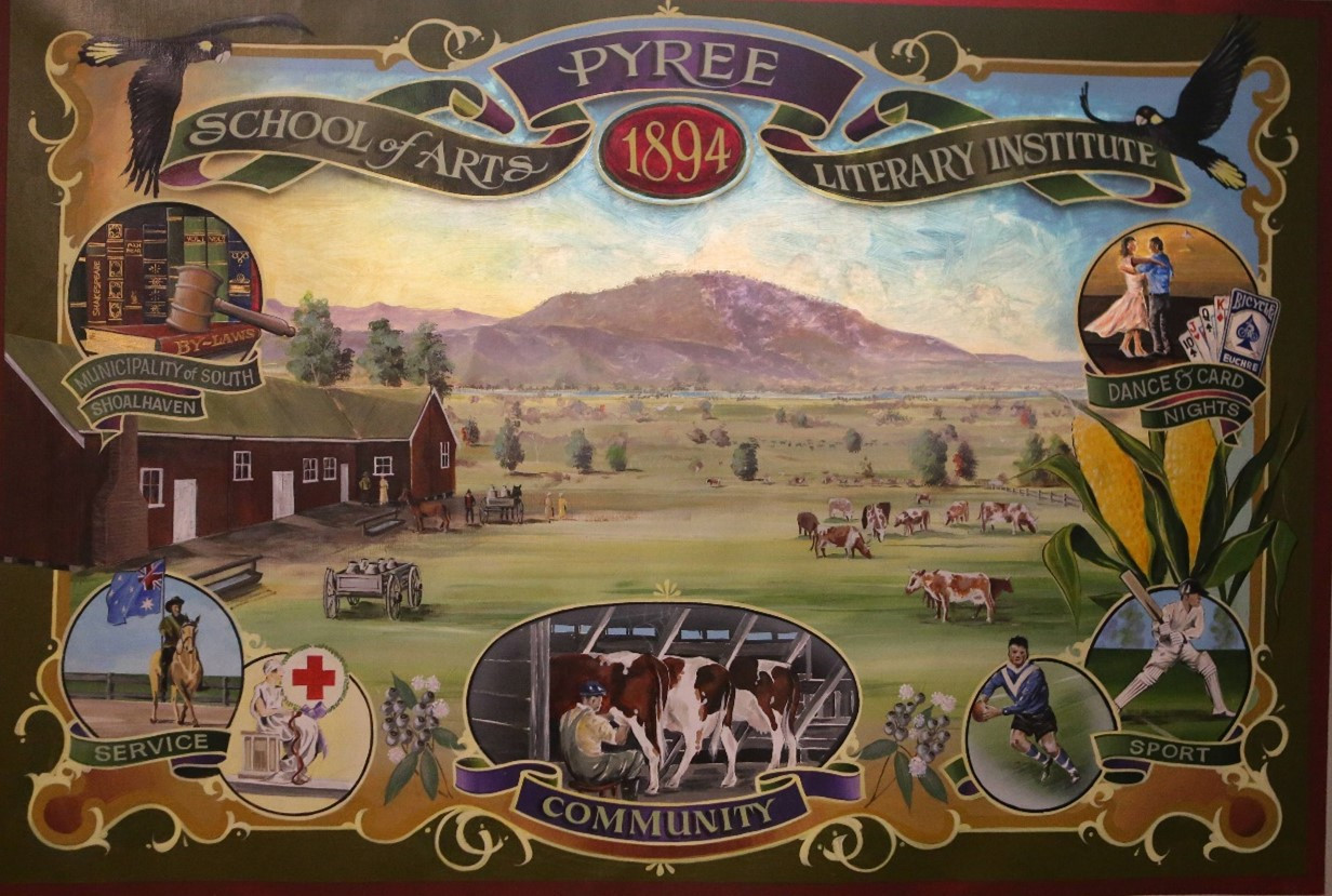
Pyree Literary Institute, 880 Greenwell Point Road
Victorian Georgian Schoolhouse (former Pyree Public School) and Coral trees, 888 Greenwell Point Road
Pyree Public Schoolmaster’s Residence (former), 890 Greenwell Point Road
“George Borrowdale’s house”—(former Berry Estate cottage), Pyree Lane
Pyree War Memorial Tree triangle (Lophostermon confertus) Pyree Lane
“Somerset House”—Federation weatherboard farmhouse and trees, 117 Pyree Lane
“Thistlebank”—Dairy Farm Complex, 85 Ryans Lane