South Coast NSW History Story
MORUYA
In 1826 Governor Darling decreed that land grants could only be issued within the boundaries of so-called Limits of Location, and in 1829 those Limits of Location surrounding Sydney were extended to encompass Nineteen Counties. The most southerly of these, on the coast, was the County of St Vincent that extended south from the Shoalhaven River to the northern bank of the Moruya River.
It’s unsurprising, therefore, that the earliest settlers in the area surrounding Moruya were in the area to the north of the river (these included Francis Flanaghan who was granted title to 4 square miles of land in 1829 and John Hawdon who was also granted 4 square miles of land in 1831) – an area that surveyor Robert Hoddle had described as ‘very barren, at least nine-tenths of it will be suitable for no purpose whatsoever.’ Broulee then became the area’s sea port.
On the southern side of the Moruya River, in 1835, a William Morris squatted on a block that he called Gundary (squatters were able to occupy land – and some acquired enormous areas, such as George Imlay’s 960,000-acre ‘Bigga’ squat – but they could not obtain a title to the land (at least up until 1842 when Governor Gipps enacted changes)). In 1845 Morris sold his land to William Campbell.
The township of Moruya emerged to service those who had moved to the area. It was on the south side of the Moruya River (on slightly higher, therefore less flood-prone, ground) at a point where a ferry connected the township to the road (more accurately, track) that ran east to the Broulee port. The town was surveyed and named ‘Moruya’ (possibly being derived from an Aboriginal Tharawal word ‘mherroyah’ meaning ‘home of the black swan’) by Samuel Parkinson in 1850. It was officially gazetted the following year. Land sales commenced in 1852, with William Campbell being a major purchaser.
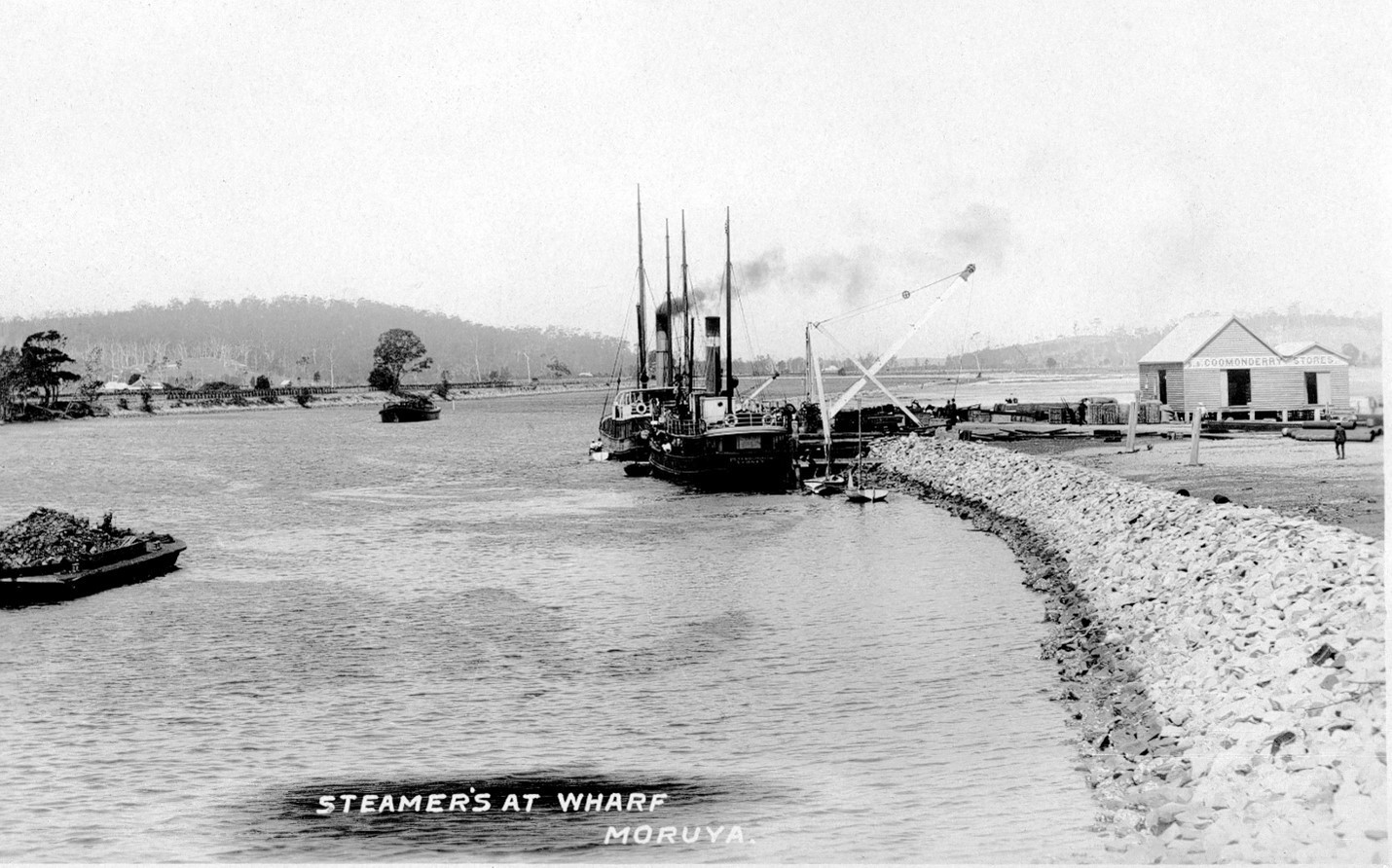
An ongoing problem for Moruya has always been the transportation of goods to and from its markets. Broulee was never really suitable to be a port; the track between Broulee and Moruya was never properly developed; and goods had to be handled multiple times both across the river at Moruya and onto or off ships waiting offshore at Broulee. And until 1841, when a substantial flood washed out the bar at the mouth of the river and opened it up to coastal shipping, vessels could not enter the Moruya River. But access to Moruya township via the river was relatively short-lived and Moruya’s transport problem was unable to be finally solved until suitable roads and road vehicles became available.
The first bridge across the Moruya River was opened in 1876. Replacement bridges were completed in 1900, 1945 (replacing the 1900 bridge that was washed away by a flood in 1945; this 1945 bridge was a ‘temporary’ bridge) and 1966.
The decline of the settlement of Broulee, from the 1840s and 1850s, led to Moruya becoming the administrative centre of the district. In 1861 a Church was built (which was replaced by the current St John’s Church in 1891), in 1862 a Beehive Store became the centre of the town’s commercial activity, and by 1863 the police had a presence in the town. (Numerous significant 1860s, 1870s and 1880s buildings still remain a feature of Moruya today.)
Agriculture has been a mainstay of the area. But the town has also been significantly affected by the Araluen Valley gold rushes that began in 1851 and, more recently, by the quarrying of granite from both sides of the Moruya River.
Tourism, to quote the Eurobodalla Shire Council, is now ‘our main economic base’, contributing over $250-million per year in income to the area.
(Downstream of Moruya, on the northern side of the river, is the site of the Granite Town township. Further downstream is Garland Town, named after James Garland who purchased 980-acres in the area and subdivided it into smaller blocks that he, unsuccessfully, marketed as Garland Town. Further down again was the three-runway Moruya Airfield which was constructed by the RAAF in 1942 for aircraft undertaking coastal patrols and as a refuelling point for aircraft transiting the area. In October 1944 it was downgraded to an Emergency Landing Ground.
On the south side of the river is the site of Loutitt’s Quarry that, from 1868 to 1887, supplied granite that was used on some of the iconic Sydney buildings and monuments, and further downstream was the Moruya Heads Pilot Station that operated from 1861 to 1953.)