South Coast NSW History Story
JERVIS BAY
Jervis Bay – Bay of Plenty on the South Coast
Booderee, ‘Bay of Plenty’. That’s how the traditional Aboriginal people, appropriately, called the land that we now know as Jervis Bay. It is no surprise that today Jervis Bay is an extremely popular tourist destination and approximately 450,000 tourists visit each year to enjoy its white sand beaches (reputedly the whitest in the whole world), for swimming or kayaking, snorkelling and scuba diving.
But Jervis Bay is a lot more than white beaches, and the bay has a very interesting history which is surprisingly closely-linked to some of the big national events that shaped modern day Australia.
Location
Jervis Bay is a series of small, holiday villages and small towns (Huskisson, Vincentia, Hyams Beach, Callala Bay), an impressive park (Booderee National Park), two lighthouses (one active, one an historic ruin), a small coastal piece of the Commonwealth of Australia (Jervis Bay Territory) and, most importantly, a huge natural harbour which, at a depth of 27 metres, is thought to be the deepest sheltered harbour in Australia.
The shoreline of the bay is bisected by Currambene Creek. On the southern side are Hyams Beach, Huskisson, Vincentia and Bowen Island. North of the creek are Callala Beach, Callala Bay, Myola, Currarong and the Beecroft Peninsula.
Traditional owners
The early Aboriginal people of the Jervis Bay area were from the Dharawal-Dhurga language group. But many Aboriginal tribes have very strong connections to Jervis Bay.
Archaeological finds at Burrill Lake, 55 kilometres south of Jervis Bay, provide evidence of Aboriginal occupation dating back 20,000 years. There is evidence that the bay was formed 11,000 years ago, after the last ice age, which means that the Tharawal were living in the area at the time of the bay's formation.
They moved around the bay and tended to camp on headlands, along the beaches and in more secluded rock shelters. Their diet comprised shellfish, fish from the estuaries, small marsupials, penguins and mutton birds which they caught on Bowen Island.
The Yuin Nation, which consisted of 12 clans at the time of European arrival to the area, are the traditional custodians of the land and water surrounding Jervis Bay/Booderee. They have a continuing connection to the Jervis Bay area and in December 2016, applied for recognition of their native title.
The bay shows continuity of Aboriginal settlement with the local indigenous community living in a protected area near Wreck Bay on the southern peninsula. The Jerrinja Tribal people living on the northern peninsula have a history in the Shoalhaven from before British ships sailed into the Shoalhaven River and David Berry established his Coolangatta Estate.
European settlement
Jervis Bay was sighted by Lieutenant James Cook aboard HMS Endeavour on 25th April 1770, and he named the southern headland Cape St George. The harbour was named "Jervis Bay" in August 1791 by Lieutenant Richard Bowen. He named it after Sir John Jervis who later became Admiral of the British fleet.
Survivors from the Sydney Cove shipwreck in 1797 reached the area by foot whilst heading to Port Jackson. Explorer George Bass entered the bay on 10 December 1797 and named Bowen Island.
The earliest accounts of contact between Europeans and Aboriginals on the South Coast happened by way of the sea. The meeting of two oceans and weather systems led to frequent storms, and survivors of wrecked ships were the first to visit the coast. The first recorded contact was by the survivors of the Sydney Cove, a trading ship travelling from Bengal to Port Jackson, which was wrecked on an island in Bass Strait in 1796. A party of 17 men left in a longboat for Port Jackson but were run aground on the coast of East Gippsland and so set out to walk to Sydney. On this journey they were assisted by Aboriginal people they met on the way, often with meals of fish or shellfish.
These early contacts marked the beginning of further exploration and strengthening of British settler control during the 19th century.
In the 19th century, British colonization in Australia saw the establishment of six separate colonies and the development of self-governance. The colonies experienced significant social and cultural changes, including the growth of small towns and the rise of new industries. Railways and other infrastructure projects were developed to connect major cities and facilitate trade.
Some of these trends are reflected in the Jervis Bay area. During this period, the area was visited and surveyed, and a lighthouse was built in the 1860s at Cape St. George. However, it wasn’t until the 1880s that the first true European settlement was established with a small plot of land then being used for sheep and cattle grazing, and for a fishing business. Land grants were issued, and land was taken up by cedar cutters and dairy farmers.
The period also witnessed tensions between settlers and Aboriginal Australians. The expansion of settlements led to the dispossession and displacement of Aboriginal peoples, with significant impacts on their lives and culture.
Alexander Berry's takeover of land in the Shoalhaven displaced its Aboriginal inhabitants, who were moved to Wreck Bay in 1822. Smallpox and syphilis then significantly reduced their population.
A separate population of Aborigines, who settlers called "the Jervis Bay tribe”, the Wandandian people, remained on their traditional lands on the bank of Currambene Creek near Huskisson, and around St Georges Basin, until well into the 20th century. They had connections to the Yuin and Tharawal nations.
The Wool Road
The settlement of Huskisson was established in 1840. A major step towards integrating the bay into an emerging national infrastructure was achieved in 1841 when the bay was connected by The Wool Road from Nerriga in the Southern Highlands. The track was originally cut by about 70 convicts in ten months to take wool, wheat, hides, etc. from the Braidwood, Goulburn and Canberra areas to the coast for shipping to Sydney. The road passed St Georges Basin and finished at South Huskisson.
The settlement of Huskisson was established in 1840.
A hotel, wharf and wool store were erected at the separate settlement of South Huskisson on the land south of Moona Moona Creek—now Vincentia. South Huskisson was founded in 1841 as a seaport and terminus of The Wool Road.
Huskisson only began to grow, when it became the site of shipbuilding in the early 1860s. From 1864 to 1977, at least 131 registered wooden-hulled vessels were built in Huskisson, in shipyards along Currumbene Creek. That number does not include the many unregistered wooden-hulled vessels—such as small boats, punts, barges, and timber lighters—that were also built there during that period.
The shipyards built sailing vessels and steamships, including schooners, tugboats, island-trading ships during the 1930s and 1940s and two passenger ferries for Sydney (Lady Denman in 1911 and Lady Scott in 1914).
By the 1890s, Huskisson began to be a holiday destination, hinting at the future direction of the town. The Dent family opened the Jervis Bay Hotel in 1893 and operated guesthouses on the beachfront.
Could-have-been: Dreamers and Schemers
In 1901 the six colonies eventually united to form the Commonwealth of Australia marking a significant milestone in Australian history and the start of some major changes to Jervis Bay’s history.
The ‘Bay of Plenty’ certainly has seen plenty of grandiose plans and proposals aimed to dramatically transform the bay and its role in the newly founded Federation. Any of those plans could have dramatically changed the life of the people living there. But apart from being ambitious, the plans had in common that they failed to materialize - for the better of Jervis Bay, many locals would argue!
Jervis Bay City - Plan 1
Jervis Bay, with its strategic location and port, was a candidate to become the new national capital of the new independent Federation. Preparations were made to create a new modern city in the bay: Jervis Bay City. Tiny Callala Beach on the northern side of the Bay was part of the design of Jervis Bay City.
The proposed development of Jervis Bay into a modern city, and in particular its projected residential development, appears to be indirectly attributed to the ideas of Walter Burley Griffin and his vision for Canberra. Burley Griffin’s design was to cover an area from where Callala Beach Road joins Forest Road, south towards Callala Beach. The City was to contain churches, schools, hotels, banks, theatres, a museum, a cricket field, park, warehouses, railway station, library; these were symmetrically placed on a plan of straight and semicircular streets.
One interesting detail was that Sir Henry Parkes, the "Father of Federation", owned four portions of the land and was one of the three original landowners in the area!
The site of the federal capital city was decided in 1908. In the end, all seriously-considered sites were substantial distances inland. Therefore, the capital and its port would have to be separate.
By 1913, the capital city was being established. It was formally named Canberra that year.
So, Jervis Bay City never did eventuate although some of the bush was cleared for roads. Here and there, traces can still be distinguished, such as the street plan of Callala Beach.
But that was not the end of it. Jervis Bay as the national port remained clearly in the sights of federal politicians.
Jervis Bay Territory and Pacific City - Plan 2
Jervis Bay was not to be the new national capital, but it certainly remained the preferred national port for the capital. To make that happen, it was necessary to create a new Jervis Bay Territory, independent of NSW. In 1911 the decision was made to create an independent federal territory with access to the sea, leading to 7,400 ha of Jervis Bay being carved off New South Wales. It became a Commonwealth owned and controlled port and naval base. It is administered by, but is not a part of, the Australian Capital Territory. The Territory includes the settlements of Jervis Bay Village and Wreck Bay Village.
The plan for Jervis Bay Territory was ambitious. It was planned to include a grand and thriving modern “Pacific City” west of Hyams Beach and extending further west to the shoreline of St Georges Basin.
Despite a significant area of land outside the present-day Jervis Bay Village being subdivided and sold, only a small village eventuated. The vision for the territory was never realised and as of 2016, it had a standing population of only 390 and most of the territory was designated as a national park.
Wreck Bay Village is one of two villages in the Territory. The rest of the Aboriginal land makes up Booderee National Park.
The creation of the new territory led to an increased presence of the Army and Navy in the Jervis Bay and the area continued to grow steadily with the decision to open the Royal Australian Naval College at Captain’s Point in 1911. Located between Jervis Bay Village and Greenpatch on the south-western shores of Jervis Bay, HMAS Creswell is surrounded by Booderee National Park.
Creswell is listed on the National Register as a significant heritage site. Since the arrival of the naval college, Jervis Bay has maintained its status as an important naval area.
HMAS Creswell is a training facility of the Royal Australian Navy that includes the Royal Australian Naval College as well as the School of Survivability and Ship's Safety and, on the northern peninsula to Jervis Bay near Currarong, Beecroft Weapons Range.
The Beecroft Weapons Range provides targets for Naval Gunfire Support practice. The Beecroft Peninsula, however, is also the location of numerous important Aboriginal sites. Just off the peninsula is Drum and Drumsticks, a significant religious site and home to a large colony of fur seals. The Aboriginal people believe in the existence of two figures who inhabit the Beecroft Peninsula: Bundoola & Spundula, creatures who control ocean resources and weather patterns respectively.
Going Nuclear - Plan 3
In the late 1960s, a plan was launched to transform Jervis Bay by erecting the country's first nuclear power plant. A steelworks, petrochemical plant and an oil refinery were also slated for the site. What was not announced was a plan to generate weapons-grade plutonium that could have seen Australia become a nuclear power.
A site was prepared. An access road was constructed to the site, on the southeast corner of the bay near Murray's Beach and the site was excavated and levelled.
But the project was delayed when William McMahon became prime minister in 1971, and shortly after Gough Whitlam signed a treaty that ended any plans to make atomic weapons. So, the proposal was abandoned in 1971.
The levelled site is now the car park for Murrays Beach and its adjacent boat ramp.
Booderee National Park
In 1995, ownership of the National Park was transferred to the Wreck Bay Aboriginal Community. The Booderee National Park has significant cultural and historic interest to both the Commonwealth and Aboriginal people and is now jointly managed by the Aboriginal community of Wreck Bay and Parks Australia.
Aboriginal people started a small settlement on Jervis Bay at Summercloud Bay in the early 1900s. They favoured that area because of its strong cultural ties, its closeness to both the bush and the sea enabled collection of food and other resources, and because of its distance from European settlements. Aboriginal people established camps where food and water were abundant and hunting and gathering were bountiful. Booderee forms part of a network of sites, places and landscapes that have helped provide generations of Aboriginals with the knowledge and understanding of how to properly manage and live with these lands and waters.
This area later became an Aboriginal reserve, known as the Wreck Bay Aboriginal Reserve, and was put under control of a mission manager. At the beginning of the 20th Century, Booderee was used for agriculture, farming and forestry.
A desire to protect Booderee’s unique natural and cultural history didn’t really start until the early 1970s. Throughout the 1970’s land rights became an important issue and, in 1986, The Aboriginal Land Grant (Jervis Bay Territory) Act was enacted. In 1995, Jervis Bay National Park and Jervis Bay Botanic Gardens Annexe were granted to the Wreck Bay Aboriginal Community Council, giving the Koori Aboriginal group ownership of the land.
The transfer of the park saw the land leased back to the Federal Government for 99 years in return for a share of the income that the park generates and a majority Aboriginal presence on the management board. In 1998, Jervis Bay National Park was renamed Booderee National Park, meaning ‘bay of plenty’ in the Dhurga language.
Protecting Booderee’s unique natural environment recently became the centre of national news when the local Aboriginal Council and the Commonwealth got involved in a serious dispute after the residents of Wreck Bay alleged that the Department of Defence negligently allowed PFAS chemicals to leach into surface water, groundwater and soil.
The contaminated river runs from HMAS Creswell into Wreck Bay. The chemicals are found in firefighting foams that had been used for more than three decades from the 1970s at HMAS Creswell and the Jervis Bay Weapons Range.
Shipwrecks and lighthouses in the Bay
The waves in this part of the south coast are generally quite high, and it is easy for a ship to be destroyed. The name ‘Wreck Bay’ says enough and the list of ships that were destroyed near or in the bay is long. Therefore, it is not a surprise that light houses play an important role in the history of the bay.
These days, the Cape St George Lighthouse is a beautiful, evocative and peaceful site inside the Booderee National Park, Jervis Bay. But this is perhaps Australia's most cursed lighthouse, and its story is one of calamitous error and personal tragedy.
For a start, the Cape St George Lighthouse was built in the wrong place. It was designed by colonial architect Alexander Dawson, who is best known for his work on the Sydney Observatory. Construction of the Cape St George lighthouse began in 1854, and the elegant structure was completed in 1856. But the lighthouse was built about four kilometres north of where it was supposed to be, probably because it was easier to get the stone there.
The end result was a lighthouse that was pretty much useless. It couldn't be seen from the northern approach and could barely be seen from the southern approach.
In 1876, 40 men drowned when the S.S. Dandenong foundered nearby. This tragedy contributed to a decision to construct a better located lighthouse at Point Perpendicular on the northern peninsula to Jervis Bay.
But it took 39 years for new lighthouse to be built. That was too late for a number of ships with the Department of Agriculture, Water and the Environment listing 13 ships that were wrecked around Jervis Bay in that period. Other sources estimate that significantly more met their end.
But even with the new, usefully placed lighthouse there remained a problem. There were now two lighthouses very close to each other. One of them marked the entrance to the bay, and the other could easily be mistaken for that. When the moonlight hit the sandstone, the Cape St George Lighthouse was an outright hazard, potentially luring ships onto the rocks. So eventually, in 1901, a decision was made to take the tower down using explosives, creating the ruins we see today.
- by Hans Berendsen
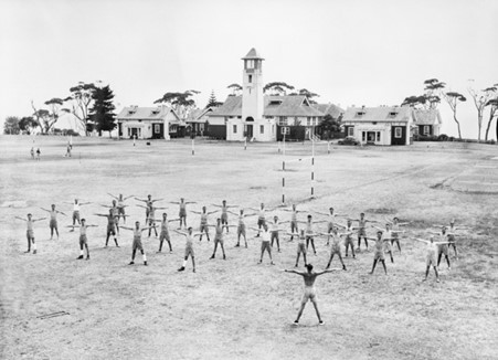
Image: HMAS Creswell, Jervis Bay