South Coast NSW History Story
GERRINGONG
The original inhabitants of the Gerringong area were Aboriginal people of the Dharawal language group. They were moved from the land following the arrival of cedar cutters in the 1810s and then by settlement by farmers (predominantly dairy farmers) from the 1820s.
Surveyor-General John Oxley and Assistant Surveyor-General James Meehan led two separate expeditions through the Gerringong area in late 1819. Oxley's report of good soil in the area heightened the interest in agricultural settlement of the district.
The first land grant in the Gerringong district was made in 1821 to a William Smith who obtained 600 acres – much of it swamp - at Omega, inland from Werri Beach and now on the northern outskirts of Gerringong. He on-sold it to a Scottish immigrant, Robert Miller, in 1835 who named the property Renfrew Park (after Renfrewshire near Glasgow in Scotland). He immediately set to work on what was considered an impossible task, draining and clearing the swamp lands on his property, ultimately transforming it into some of the area's richest pasture lands.
Land to the north of Smith’s holding, up to Mt Pleasant, was granted to Lieut. Thomas Campbell and was named ‘Omega Retreat’; land to the west of Smith’s holding was acquired by Michael Hindmarsh and was named ‘Alne Bank’; most of the land to the south of Gerringong was part of Alexander Berry’s Coolangatta Estate.
Campbell’s land was transferred to his brother-in-law, James Gray. Gray had ‘clearing lease’ arrangements with 20 tenants (they were required to clear the land for farming within 5 years). Berry had a similar arrangement with many of his tenants.
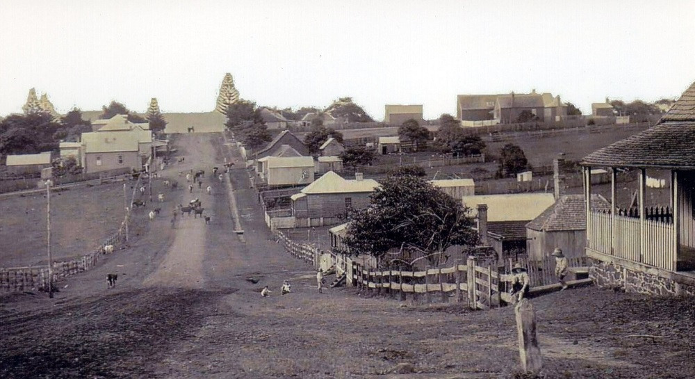
In 1824, 600 acres were reserved by Governor Brisbane for Gerringong township. By 1829 it had a post office. In 1854 a town plan for Gerringong was approved and the Governor proclaimed it a village.
It is commonly believed that Gerringong is an Aboriginal name for this area, but there is no certainty about what the name means. And Gerringong has undergone various spellings over the decades, contributing to uncertainty about the origin of the name.
Originally just part of the District of Five Islands – or Illawarra – the first land grant (to William Smith) was made by Governor Sir Thomas Brisbane on 19 April, 1825. It was in an area called Jaron Gong, supposedly with “gong” being a Dharawal suffix word for a “swamp”, which would seem appropriate, given the area known as Miller’s Flats (or Swamp), Smith’s Swamp and the marshy Ooaree Creek.
But what does “Jaron” refer to? There is some suggestion that the Dharawal word for the Illawarra Black Apple (or Black Plum) – Podocarpus elatus (or Planchonella australis) - was “Jaron”. If this is the case, then Jaron Gong may well have meant “a swampy place for black plum fruit”. Given that many Aboriginal place names refer to a food source, this is a strong contender for the meaning of “Gerringong”. One problem, however, is that, as a suffix, “gong” can also mean “hill”, or can even indicate a personal name.
On 1st June, 1829, the Jaron Gong area was officially gazetted, for the first time as “Geringong”; but by 1846 it was “Jeringong” in Government Notices; and, by 1850, “Jerringong”. Other spellings, in various printed notices, were: Gerronogong, Gerrigong, Gerongong, Gerringong, Jerrangong, Jarrengong, Jerrengong and Jerrygong. A Town Plan for the Village of Geringong was drawn up in 1853 and submitted to Governor Fitz Roy on 9th January, 1854. It was not until a Post Office was gazetted for the town, on 30th March, 1857, that the current spelling (and pronunciation) became official in the post mark of Gerringong Post Office. The spelling was now fixed, but the meaning still uncertain. To complicate matters further, there was also a Wodi Wodi Aborigine by the name of Jerrengong (identified in the 1834 blanket records) who may have lent his name to the locality, just as Tullimbar did, near Albion Park.
In the late 1860s and early 1870s locals started pushing for the construction of a jetty at Gerringong’s Boat Harbour, the area that originally had been used by cedar getters to ship logs to Sydney and which later became the shipping hub for local produce. (A store was erected there to cater for the needs of shipping in the 1850s.)
In 1880, a 200 foot-long jetty was constructed, but it proved to be too short to allow coastal ships to berth. So, it was extended by 200 feet, and subsequently by another 100 feet, in the mid-1880s. But, it was to have a short life: it was extensively damaged in a storm in 1891, was rebuilt, only to be damaged again in 1892. Then the South Coast railway line reached Gerringong in 1893 – effectively ending shipping services to the area and making the jetty redundant. Around 1901 much of the jetty was removed and used as bridge material. The last remnants of the jetty were washed away in 1904.
Meanwhile, in 1859 the Municipality of Kiama, incorporating the Gerringong area, was established. Almost immediately Gerringong locals expressed dissatisfaction about how local money was being spent and started lobbying for the establishment of a separate Gerringong municipality. They ultimately were successful and Gerringong Municipal Council was incorporated in 1871. (Gerringong Council and Kiama Council re-amalgamated in 1954!)
In 1872 a significant portion of Gerringong township was destroyed by a bushfire. This the Sydney Morning Herald’s report of it: ‘dwelling houses, shops, and other buildings, constituting a large proportion of the Village of Gerringong, have been completely destroyed and several families left for the time houseless…the conflagration took its rise from fires which had been kindled in the native timber, the flames being carried from point to point by the violent wind which prevailed during the night of Monday - a wind so violent and continuous…Among the buildings which have been completely destroyed, we may mention the Lanterrick Hotel, Mr Joseph Perkins's store, the Church of England Certified Denominational School, and the teacher's residence adjoining.’
A Gerringong Co-Operative Dairy Society was established in 1888, to give local dairy farmers greater bargaining power by combining their milk productions. The co-op initially operated from a timber building and moved to a brick building near the railway station in 1908, where a siding made it feasible to transport milk to Sydney by train. It was to be the oldest continually operating dairy co-operative in Australia until its closure in 2007.
Many of Gerringong’s historic landmarks are identified in a small pamphlet, ‘Heritage Walks of Kiama & District’, available free from local Libraries and Visitor Information Centres.